


The worst of the storm was over, but there were still lingering signs as I approached the Meigs Point section of Hammonasset State Park. Sand spilled out into the roadway, and low-lying stretches were flooded by tide and rain. Every so often the car would shake as it was broadsided by a leftover gust of wind.
Crowded in the summer months, I visit Hammonasset mostly during the spring and fall - occasionally in stormy weather. With few, or no others around, it's like having the amusement park all to yourself.
I walked the high-tide line of East Beach, eventually climbing the short bluff at Meigs Point, and its large glacial erratics. I thought back to my visit last fall when I stood atop these rocks and could see Falkner Island to the west, and Plum Island to the east. Looking across the Sound at Long Island, I wondered which towns it was I was viewing. Mattituck perhaps?
Today it didn't matter as I was lucky enough to see beyond the western edge of the park.
The rain began falling again, so I pulled up my hood. The air was raw - far too cold for the month of May. After such a mild winter, this was perhaps a bit of payback for those summer days we received in March.
Mother Nature has a way of evening the score.

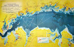
CT Coastal Access Guide: Hammonasset State Park