Saturday, November 28, 2009

Excalibur


Switching channels the other night, I came across a show entitled Lobstermen, which appears to be some sort of spinoff by the Discovery Channel of their popular Deadliest Catch series. The show features several Point Judith and New Bedford fishing boats working the waters of Georges Bank. Like many of these programs, it follows a formula that fudges the line between a documentary and a reality show. Drama disguised as insight!

One of the Point Judith boats on the show is the dragger Excalibur. Last March, I caught the Excalibur loading up and leaving the dock in Stonington. Little did I know at the time, I was looking at a celebrity.

SOUNDBOUNDER: Stonington Fishing Fleet

Tuesday, November 24, 2009

Upstream In Vermont


When I was in college, a friend and I spent a Columbus Day weekend paddling a canoe down a portion of the Connecticut River. My memory is fuzzy on the specifics, but we launched the canoe on a tributary somwhere near Ryegate, Vermont; paddled our way to the Connecticut River; then worked our way south to Bradford. When our arms were tired, we would try to calculate how long it would take to reach the mouth of the river by simply flowing along with the current. We concluded that the numerous dams above Hartford, and the tides below, made it impossible to determine. We then returned to more serious conversations about baseball, girls, and music.

Ninety percent of the freshwater that enters Long Island Sound comes from three sources: The Connecticut, Housatonic, and Thames Rivers. Extending 400 miles from Old Saybrook to Quebec, the Connecticut is by-far the largest in both volume and distance. As the map above illustrates, there are many streams in Massachusetts and Vermont that are part of the Connecticut River and Long Island Sound watershed. This year I thought it would be interesting to occasionally post a story about the tributaries that feed into the Sound. Posts labeled UPSTREAM  will look at places within the Long Island Sound watershed.

Despite having attended school in Vermont, I only seem to get back there infrequently these days. My sister Erica however, works for the VT Department Of Tourism and started a blog this year entitled Happy Vermont. The photo above is from her story about Quechee Gorge and the Ottauquechee River that feeds into the Connecticut River. Vermont is a beautiful state! Whether you visit often, or are someone who has never been, be sure to check out her site.

Happy Vermont Travel Blog
Soundkeeper: LIS Watershed
Quechee Gorge: Map
image credit: Happy VT (top); Wikipedia (bottom)

Sunday, November 22, 2009

Friday, November 20, 2009

Mary E


The Mary E is a 75 foot coastal schooner built in Bath, Maine in 1906. She worked as a fishing and cargo schooner off Rhode Island, before being converted to a motored dragger in the 1940's. She sank in Lynn, Massachusetts during a 1963 storm, but fortunately was restored in the following years. Presently, the Mary E offers 90 minute sails from the docks at the Connecticut River Museum in Essex.
After many years in Greenport, a dispute with the village forced her to leave. There were several years where the Mary E seemed to bounce around with no true home port. She spent a portion of one season in City Island, and I have also seen her in New Rochelle (that's her in the background). Hopefully things work out in Essex, and she has a long successful run.

Wednesday, November 18, 2009

Wreck Of The Celtic


Twenty-five years ago this week, the tugboat Celtic sank  about a mile-and-a-half south of Sheffield Island. Towing 1400 tons of scrap metal from Bridgeport to Newark, she sank in 75 feet of water, taking along with her the seven crewmembers. An investigation later revealed that the barge she was towing, the Cape Race, had recently undergone repairs to fix several leaks. They concluded that the repairs failed, the barge filled with water, then sank, pulling the Celtic down on the evening of November 17, 1984.
Built in 1958 at the Jakobson Shipyard in Oyster Bay, the tug was named Russell 10 (above), then the Judith McAllister, and eventually the Celtic.

I have never been scuba-diving, but a few years ago I bought a book at a yard sale entitled Shipwrecks of  Long Island Sound (or something to that effect). There are many more wrecks on the bottom of the Sound than I imagined. This past year I discovered the Wreckhunters website, and Dave Clancy was kind enough to provide me with some background information on the Celtic.

Wreckhunter: Hunting New England Shipwrecks
Jakobson Shipyard: Shipbuilding Registry
CT Harbor Management: Salvage 2008 (page 4)
AquaExplorers: Celtic Shipwreck
Map
photo credit: Tugster

Tuesday, November 17, 2009

Greenwich Point


This is the epicenter of the coastal access debate. Permission to enter the 147-acre Greenwich Point has been an issue brought to the courts several times these past two decades. For those of you unfamiliar with the story, here is a brief history.
In the 1990's, Stamford resident and law school student  Brenden Leydon was denied entry to Greenwich Point while jogging. The town maintained a policy that restricted entry to residents only. He filed suit in 1995, and the case made it's way to the State Supreme Court in 2001. The court ruled that Greenwich could not deny Mr Leydon access to a public space. Problem solved? Not so fast.
Greenwich opened their beach and park to nonresidents, but made sure to put in place a series of obstacles  for anyone who tried to visit. Fees for nonresidents were extremely high, plus a permit was required for entry. This nonresident permit could only be purchased at the town offices, which were miles away. Sure enough, the office was only open till 3:45 PM on weekdays, and closed on weekends. Take that,.. Supreme Court!
In 2005, 75 year old Paul Kempner rode his bike into Greenwich Point and was fined $92 for trespassing. He filed suit claiming that the fees charged for nonresidents were prohibitive. The town responded by lowering their fees, and allowing free entry for retirees. The permit requirement remains in effect.

Another case in 2005 involved three female residents of Greenwich who were excercising in the park.The black and Hispanic women (wives of former major league baseball players) were told that 3 people constituted a group, which requires a permit, and therefor they had to leave. Some incriminating emails from a town official later surfaced,  confirming the women's suspicions.
Greenwich has tried to portray themselves as a victim in this saga, but they have brought most of this bad publicity upon themselves.

From November 1 through April 30, Greenwich Point (aka Tod's Point) is open to all with no fees or residency permit required. The photos above show the south portion of the park between the lake and Bluff Point. A walkway curves along the shoreline, and is dotted with several wooden bridges that cross the tidal outlets of some nearby salt ponds.

Map
Connecticut Post: Public Access Not Always Easy
New York Times: One Man's Crusade
New York Times: In Greenwich, Group Hugs Are Few
CT Coastal Access Guide: Greenwich Point Park
Sphere: Don't Expect A Warm Welcome

Sunday, November 15, 2009

Farewell To The Knickerbocker


The Knickerbocker Yacht Club is now vacant. The clubhouse with its hipped roof and second story deck silently looks out over Manhasset Bay. Resembling a foreclosed home, several No Trespassing signs are now taped to the large bay windows. After hearing the news that the 135 year old club had closed, I stopped by this month for one last goodbye. A utility worker making a phone call in the parking lot was all that broke the silence.


Yacht Clubs certainly do not inspire any populist imagery, but stereotypes of Buffy and Thad sailing in white slacks while maintaining a stiff upper lip are not entirely accurate. On Long Island Sound, yacht clubs tend to fall into one of three categories:
There are the exclusive clubs that do their best to hold on to the Guilded Age. These are often easy to spot with their clubhouses resembling some gold coast mansion, and their staff dressed like butlers. At the other extreme would be the working clubs whose membership often includes a high percentage of firemen, teachers, and tradesmen. These are normally do-it-yourself places where members volunteer their time along with paying dues. When the grass needs to be cut, it is a member mowing the lawn, not an employee or a landscaping company.

 The Knickerbocker belonged to a group that is somewhere in between these two extremes. These clubs often navigate a foggy channel between controlling expenses and maintaining a certain aura of exclusiveness. Members may own an expensive boat, but they also have tuition bills and a mortgage.


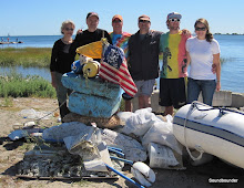
For years I belonged to a working club that was about a two hour sail from Manhasset Bay. I only sailed to the Knickerbocker a handful of times, but the visits were always special to me. I would motor my old banged-up 1968 Bristol 24 into the mooring field, hail a launch, and be welcomed to the club. It did not matter that my boat cost less than a used car, while the surrounding boats were priced similar to a starter home. I may have not met the financial or social requirements to be a member of the club, but I was accepted as a guest providing I followed their rules (proper attire in the dining room, no tank tops on the premises, no spitting).I could hobnob with the doctors and architects in a mahogany trimmed bar until I turned back into a pumpkin on Monday morning. Reciprocity between clubs was the great leveling field, if only for a weekend.


When the recession hit, it was easy to question my club's chances of survival. The rundown building, the old boats, and even older membership all suggest that the best days were at least 40 years ago. The Knickerbocker did not seem to have these problems. The model ships and half hulls adorning the walls seemed to suggest an immunity to changing times. But beneath the mahogany and cherry wood paneling, the Knickerbocker was struggling with the same difficulties as every other club. Higher expenses coupled with an aging and declining membership were a disturbing trend that every club from Watch Hill to Throgs Neck faced. The prosperity of the last 25 years helped suppress the symptoms, but the current financial crisis brought them to the forefront.


At one time or another, I think we have all secretly admired yet resented people in better places. A neighbor or colleague may be someone we desperately want to be, yet we begrudge their good fortune. When bad times strike, their failure becomes some sort of "moral to the story". But I felt no sense of schadenfreude when I walked along the empty dock at the Knickerbocker this month. The club had survived two world wars, the Great Depression, and September 11, but now it was gone. I thought to myself that if it could happen to the Knickerbocker Yacht Club, then it could happen to any of us. I leaned against the peeling white handrail, looked out over the harbor, and wondered "who's next?"

Map

This post is the first draft of a story which appeared in Newsday, 12/09  IF IT COULD HAPPEN TO THE KNICKERBOCKER

Tuesday, November 10, 2009

Glen Island Bridge


Glen Island was originally a private resort created in the late 19th century, that consisted of several islands linked by causeways and footbridges. To reach the islands, one needed to arrive by excursion boat, or take a small ferry from New Rochelle. When Westchester County purchased the land in the 1920's, the islands were connected with fill to create one large island. The drawbridge shown here, was also constructed to connect the park to the mainland. The stonework and streetlamps make this an attractive bridge. Today, the 105 acre Glen Island is the second most visited county park in Westchester.
*
Westchester.com: Glen Island Park

Monday, November 9, 2009

Sailing With Cancer


I don't remember much about the first time Monica came sailing with me. I do know it was about a decade ago aboard my old banged-up Bristol 24 I kept in City Island. She was no sailor or boater, but she carried a natural affinity for the water, and felt right at home. There were no mishaps or complaints that day from myself or her; perhaps that is why I do not recall much about it.

In 2006, Monica was diagnosed with bone cancer. It has been a roller coaster ride ever since: months of relatively normal life interrupted by periods where it did not seem she would survive another week or two. It is the latter that we are going through right now.
I do not want to turn this into a political post, but those of you who think you are insured, need to think again. Fighting with the insurance companies has been just as large a battle as the sickness itself. We may have the greatest medical treatment in the world in this country, but it is a private beach, reserved for club members and waterfront residents only.

Monica worked at a hospital in White Plains for twenty years; she thought she had great insurance. Most of the cable-TV jockeys seem to frame the argument around the insured versus the uninsured. There are large numbers of insured Americans who are not as insured as they think they are.


Long Island Sound has been a respite from all this morbidity and corporate nonsense, providing us with an outlet that is sometimes the greatest therapy.
 And most of all, she has been a good sport:

  " Hey Mon, instead of going to that swanky marina with the pool and tiki bar, would it be alright if we anchored near Bridgeport so I can photograph the oyster boats returning to port?"


photos: Shelter Island Ferry (top)
Stonington
Long Passage to Block Island (bottom)

Extremes II

Old Saybrook Town Beach, April 2009 (top), and October 2009 (bottom)

Saturday, November 7, 2009

Oyster Boat S.W. Sheppard


On a hazy, windless, August morning, I spotted the S.W. Sheppard oyster boat working the beds just south of New Haven. Operated by the Norman Bloom Shellfish Company, she was built at the Stowman Shipyard of Dorchester, New Jersey in 1922. Searching for information about her on the internet, I stumbled across some photos of a restoration project that looked to be from the early 1980's. Unsure if these pictures were of the same boat, I emailed the Flanigan Brothers Boatyard. They were kind enough to respond and confirm that it is indeed her.
*
Flanigan Brothers: S.W. Sheppard Restoration
Stowman Shipyard: Ship Registry
Soundbounder: Oyster Boat Columbia

Friday, November 6, 2009

Smyth Sanctuary & Pratt Cove Preserve

On a winding road connecting Essex and Deep River are two protected areas, side by side. Smyth Sanctuary and Pratt Cove Preserve both overlook the freshwater marshes here that feed the Connecticut River. They are areas best explored by a kayak or canoe.
Pratt Cove Preserve was donated by Susan Haig and is managed by the Nature Conservancy. The preserve includes a short trail, along with a launch area. Despite being freshwater, the cove is tidal, with a current that looked fairly strong when I visited.
Across the street and slightly south, is the Smyth Sanctuary. This is a wooded area maintained by the Deep River Land Trust. There did not appear to be any trails, but a viewing platform provides an attractive view overlooking the marshlands that make their way to the Connecticut River.
*
Nature Conservancy: Pratt Cove
CT Coastal Access Guide: Pratt Cove

Thursday, November 5, 2009

Wildwood State Park

The 25 mile shoreline between Port Jefferson and Mattituck is often an overlooked stretch of Long Island Sound. Other than Mt Sinai (just east of Port Jefferson), there are no harbors to be found here. The deep, curved, bays to the west, give way to an uninterupted shoreline of bluffs and beaches. It is a region that is east of the suburban sprawl, yet west of the North Fork's wineries and tourist destinations. If Long Island had a flyover region, this would be it. It is along this section of the Sound that Wildwood State Park is located. Until October, I had never visited, and was pleasantly surprised by what I found. The 600 acre park includes camp sites, a large picnic area, a playground, as well as numerous hiking trails. This portion of the park is heavily wooded, and despite the thinning foliage of autumn, there was little indication that a body of water was nearby. Only by following a walkway descending a narrow ravine did the beach and Sound come into view.
I walked east of the deck and concession stand, and was amazed at how beautiful a spot this is. The shoreline seemed infinite, with very few landmarks to distinguish one area from another. A water tower and a distant antenna were all that broke the endless shore. I thought to myself how different this view would be if the Broadwater Liquefied Natural Gas Terminal had been built. It is the flyover location I described above that has made this area vulnerable to several bad ideas.The Shoreham Nuclear Power Plant and Broadwater proposals are both located within view from this area.
With the late season sun low in the sky, some sections of the beach were shaded by the trees atop the bluffs to my south (It gets late early there). Along those stretches, I walked below the high tide mark, and weaved my way between the large rocks that were wet from the waist down. What I like most about Wildwood is the beach has been left in its natural state. In order to accommodate large crowds, state parks often groom the beaches, making them more user friendly, but less authentic. Wildwood has left in place the large glacial erratics and boulders strewn along the mile-and-a-half beach. And for now at least, it's views are undisturbed.
*